The government further designates "significant" monuments classifying them in three categories: Historic Sites (史跡 shiseki?), Places of Scenic Beauty (名勝 meishō?), and Natural Monuments (天然記念物 tennen kinenbutsu?). Items of particularly high significance receive higher classifications: Special Historic Sites (特別史跡 tokubetsu shiseki?), Special Places of Scenic Beauty (特別名勝 tokubetsu meishō?), and Special Natural Monuments (特別天然記念物 tokubetsu tennen kinenbutsu?) respectively. As of August 20, 2012 there are 919 Natural Monuments, 1632 Historic Sites, 333 Places of Scenic Beauty, 75 Special Natural Monuments, 61 Special Historic Sites and 36 Special Places of Scenic Beauty. Since a single item can fall under more than one of these categories, the total number of sites is less than the sum of designations.
Special Places of Scenic Beauty, Special Historic Sites, Special Natural Monuments
| Name | Special Place of Scenic Beauty | Special Historic Site | Special Natural Monument | Remarks | Location | Photo |
|---|---|---|---|---|---|---|
| Mōtsū-ji garden (毛越寺庭園 mōtsūji teien?)[4] | 1 |
—
|
—
|
Hiraizumi, Iwate 38°59′16.31″N 141°6′28.98″E |
 |
|
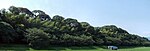
| Matsushima (松島?) | 8, 11 |
—
|
—
|
One of the Three Views of Japan | Shiogama, Shichigahama, Rifu, Matsushima, Higashimatsushima, Miyagi 38°21′59.13″N 141°4′27.87″E |
 |
| Hamarikyu Gardens (旧浜離宮庭園 kyū hamarikyū teien?)[5] | 1 | 2,8 |
—
|
Tokyo 35°39′35.3″N 139°45′46.5″E |
 |
|
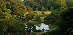
| Koishikawa Kōrakuen Garden (小石川後楽園 koishikawa kōrakuen?)[6] | 1 | 8 |
—
|
Tokyo 35°42′19.63″N 139°44′57.37″E |
 |
|
| Rikugi-en (六義園?)[7] | 1 |
—
|
—
|
Tokyo 35°43′58.66″N 139°44′47.48″E |
 |
|
| Kurobe Gorge with Sarutobi Gorge and Mount Okukane (黒部峡谷 附 猿飛ならびに奥鐘山 kurobekyōkoku tsuketari sarutobi narabini okukaneyama?) | 6 |
—
|
4 | Tateyama, Kurobe, Toyama 36°37′23.18″N 137°41′11.4″E |
 |
|
| Kenroku-en (兼六園?)[8] | 1 |
—
|
—
|
One of the Three Great Gardens of Japan | Kanazawa, Ishikawa 36°33′43.5″N 136°39′44.99″E |
 |
| Ichijōdani Asakura Family Gardens (一乗谷朝倉氏庭園 Ichijōdani Asakura-shi teien?) | 1 |
—
|
—
|
The ruins at the same site are a Special Historic Site. | Fukui, Fukui 35°59′57.95″N 136°17′43.52″E |
 |
| Mitake Shōsenkyō Gorge (御嶽昇仙峡 mitake shōsenkyō?)[9] | 5, 6 |
—
|
—
|
Kōfu and Kai, Yamanashi 35°44′41.64″N 138°33′59.29″E |
 |
|
| Kamikōchi (上高地?)[10] | 6 |
—
|
4 | Matsumoto, Nagano 36°14′24.93″N 137°37′27.07″E |
 |
|
| Konchiin Garden (金地院庭園 konchiin teien?) | 1 |
—
|
—
|
Kyoto, Kyoto 35°0′38.29″N 135°47′24.02″E |
 |
|
| Jishō-ji (Ginkaku-ji) Garden (慈照寺(銀閣寺)庭園 jishō-ji (ginkaku-ji) teien?)[11] | 1 | 8 |
—
|
Kyoto, Kyoto 35°1′35.78″N 135°47′54.31″E |
 |
|
| Rokuon-ji (Kinkaku-ji) Garden (鹿苑寺(金閣寺)庭園 rokuon-ji (kinkaku-ji) teien?)[12] | 1 | 8 |
—
|
Kyoto, Kyoto 35°2′21.38″N 135°43′43.33″E |
 |
|
| Jōruri-ji Garden (浄瑠璃寺庭園 jōruri-ji teien?) | 1 |
—
|
—
|
Also a historic site (hist-crit.: 8) | Kizugawa, Kyoto 34°42′56.16″N 135°52′22.8″E |
 |
| Saihō-ji Garden (西芳寺庭園 saihō-ji teien?)[13] | 1 |
—
|
—
|
Also a historic site (hist-crit.: 8) | Kyoto, Kyoto 34°59′32.5″N 135°41′3.81″E |
 |
| Daisen-in Shoin Garden (大仙院書院庭園 daisenin shoin teien?)[14] | 1 |
—
|
—
|
Also a historic site (hist-crit.: 8) | Kyoto, Kyoto 35°2′40.66″N 135°44′45.01″E |
 |
| Daitoku-ji Hōjō Garden (大徳寺方丈庭園 daitokuji hōjō teien?) | 1 |
—
|
—
|
Also a historic site (hist-crit.: 8) | Kyoto, Kyoto 35°2′40.66″N 135°44′45.01″E |
 |
| Daigo-ji Sanbō-in Garden (醍醐寺三宝院庭園 daigoji sanbōin teien?)[15] | 1 | 8 |
—
|
Kyoto, Kyoto 34°57′6.78″N 135°49′10.2″E |
||
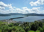
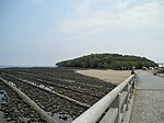
| Amanohashidate (天橋立?)[16] | 3, 8, 11 |
—
|
—
|
One of the Three Views of Japan | Miyazu, Kyoto 35°34′12.02″N 135°11′30.59″E |
 |
| Tenryū-ji Garden (天龍寺庭園 tenryū-ji teien?)[17] | 1 |
—
|
—
|
Also a historic site (hist-crit.: 8) | Kyoto, Kyoto 35°0′56.68″N 135°40′23.53″E |
 |
| Nijō Castle Ninomaru Palace Gardens (二条城二之丸庭園 nijōjō ninomaru teien?)[18] | 1 |
—
|
—
|
Kyoto, Kyoto 35°0′48.27″N 135°44′57.22″E |
 |
|
| Hōkongō-in Seijo no taki waterfall and Mount Goisan (法金剛院青女滝 附 五位山 hōkongōin seijo no taki tsuketari goisan?) | 1, 10 |
—
|
—
|
Kyoto, Kyoto 35°1′11.77″N 135°42′59.03″E |
 |
|
| Hongan-ji Ōshoin Garden (本願寺大書院庭園 honganji ōshoin teien?) | 1 |
—
|
—
|
Also a historic site (hist-crit: 8) | Kyoto, Kyoto 34°59′27.37″N 135°45′4.47″E |
|
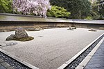
| Ryōan-ji Hōjō Garden (龍安寺方丈庭園 ryōanji hōjō teien?) | 1 |
—
|
—
|
Also a historic site (hist-crit: 8) | Kyoto, Kyoto 35°2′3.81″N 135°43′5.42″E |
 |
| Garden at the Eastern Heijō Palace (平城宮東院庭園 Heijō-kyū tōin teien?)[19] | 1 |
—
|
—
|
Reconstruction of an 8th-century Imperial Palace Garden with ponds and pebble shore | Nara, Nara 34°41′28″N 135°47′44″E |
 |
| Heijō-kyō Sakyō Sanjō Nibō Palace Garden (平城京左京三条二坊宮跡庭園 heijōkyō sakyō sanjō nibō miyaato teien?)[20] | 1 | 2, 8 |
—
|
The ruins at the same site are a Special Historic Site. | Nara, Nara 34°41′1.45″N 135°48′8.44″E |
|
| Okayama Kōraku-en (岡山後楽園 okayama kōrakuen?)[21] | 1 |
—
|
—
|
One of the Three Great Gardens of Japan | Okayama, Okayama 34°40′3.94″N 133°56′7.78″E |
 |
| Itsukushima (厳島?)[22] | 8 | 2,3 |
—
|
Includes one of the Three Views of Japan | Hatsukaichi, Hiroshima 34°17′1.99″N 132°19′5.9″E |
 |
| Sandan-kyō ravine (三段峡 sandan-kyō?) | 3,5,6 |
—
|
—
|
Akiōta, Hiroshima 34°37′28.85″N 132°11′8.97″E |
 |
|
| Ritsurin Garden (栗林公園 ritsurin kōen?)[23] | 1 |
—
|
—
|
Takamatsu, Kagawa 34°19′39.2″N 134°2′35.76″E |
 |
|
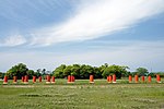
| Nijinomatsubara (虹の松原?)[24] | 3,9 |
—
|
—
|
Karatsu, Saga 33°26′35.99″N 130°0′34.37″E |
 |
|
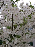
| Mount Unzen (雲仙岳 unzendake?) | 1, 3, 9, 10 |
—
|
—
|
Shimabara, Nagasaki 32°45′37.54″N 130°17′31.25″E |
 |
|
| Shikinaen Garden (識名園 shikinaen?) | 1 |
—
|
—
|
Naha, Okinawa 26°12′14.1″N 127°42′55.32″E |
 |
|
| Lake Towada and Oirase Mountain Stream (十和田湖および奥入瀬渓流 towadako oyobi oirasekeiryū?) | 6, 7 |
—
|
—
|
Also a Natural Monument (4) | Towadako, Aomori and Kosaka, Akita 40°28′23.05″N 140°52′39.67″E |

 |
| Dorohacchō Gorge (瀞八丁 dorohacchō?) | 5,6 |
—
|
—
|
Also a Natural Monument (3.1) | Kumanogawa, Wakayama, Kiwa, Mie and Totsukawa, Nara 33°52′23.24″N 135°51′27.43″E |
 |
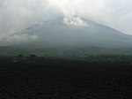
| Mount Fuji (富士山 fujisan?) | 10 |
—
|
—
|
Yamanashi, Shizuoka 35°21′28.8″N 138°43′51.6″E |
 |
|
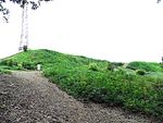
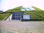
| Goryōkaku ruins (五稜郭跡 goryōkakuato?)[25] |
—
|
2 |
—
|
Star fort of the Republic of Ezo | Hakodate, Hokkaidō 41°47′49.8″N 140°45′24.3″E |
 |
| Sannai-Maruyama site (三内丸山遺跡 sannai maruyama iseki?)[26] |
—
|
1 |
—
|
Jōmon period archaeological site | Aomori, Aomori 40°48′40.24″N 140°41′44.3″E |
 |
| Chūson-ji compound (中尊寺境内 chūsonji keidai?)[27] |
—
|
3 |
—
|
Hiraizumi, Iwate 39°0′6.68″N 141°6′0.46″E |
 |
|
| Muryōkōin Ruins (無量光院跡 muryōkōinato?) |
—
|
3 |
—
|
Hiraizumi, Iwate 38°59′36.08″N 141°6′56.81″E |
 |
|
| Ruins of Shinto shrine attached to the Mōtsū-ji compound (毛越寺境内 附 鎮守社跡 mōtsūji keidai tsuketari chinjushaato?)[28] |
—
|
3 |
—
|
Hiraizumi, Iwate 38°59′13.89″N 141°6′27.26″E |
||
| Ruins of a temple attached to the fort of Tagajō (多賀城跡 附 寺跡 tagajōato tsuketari teraato?)[29][30] |
—
|
2, 3 |
—
|
Tagajō, Miyagi 38°17′57.54″N 140°59′52.41″E |
 |
|
| Ōyu Stone Circle (大湯環状列石 ōyu kanjō resseki?)[31] |
—
|
1 |
—
|
Kazuno, Akita 40°16′16.96″N 140°48′15.06″E |
 |
|
| Former Kōdōkan School (旧弘道館 kyūkōdōkan?)[32] |
—
|
4 |
—
|
Former school of the Mito Clan, founded in 1841 by Tokugawa Nariaki | Mito, Ibaraki 36°22′31.54″N 140°28′38.27″E |
 |
| Hitachi Kokubun-ji Ruins (常陸国分寺跡 hitachi kokubunjiato?)[33] |
—
|
3 |
—
|
Ishioka, Ibaraki 36°11′48.17″N 140°16′25.38″E |
||
| Hitachi Kokubun Nunnery Ruins (常陸国分尼寺跡 hitachi kokubun nijiato?)[34] |
—
|
3 |
—
|
Ishioka, Ibaraki 36°12′6.18″N 140°16′3.25″E |
||
| Ōya Magaibutsu (大谷磨崖仏 ōya magaibutsu?) |
—
|
3 |
—
|
Stone reliefs of Buddhist deities in a cave | Utsunomiya, Tochigi 36°35′46.35″N 139°49′16.94″E |
|
| Cedar Avenue of Nikkō and attached donation monuments (日光杉並木街道 附 並木寄進碑 nikkō suginamiki kaidō tsuketari namiki kishinhi?)[35][36] |
—
|
6 | 2.1 | Three roads totalling 37 km (23 mi) | Nikkō, Imaichi and Kanuma, Tochigi 36°35′46.35″N 139°49′16.94″E |

 |
| Kanaizawa Stele (金井沢碑 kanaizawahi?)[37] |
—
|
3, 7 |
—
|
110 cm (43 in) high stone stele from 726 | Takasaki, Gunma 36°17′8.37″N 139°0′58.21″E |
 |
| Yamanoue stele and kofun (山上碑及び古墳 yamanouehi oyobi kofun?)[38] |
—
|
1, 7 |
—
|
Takasaki, Gunma 36°16′37.48″N 139°1′40.09″E |
 |
|
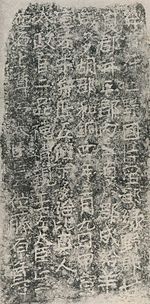
| Tago Stele (多胡碑 tagohi?)[39] |
—
|
2, 7 |
—
|
Takasaki, Gunma 36°15′54.1″N 138°59′46.67″E |
 |
|
| Ruins of Edo Castle (江戸城跡 edojōato?) |
—
|
2 |
—
|
Tokyo 35°41′8.93″N 139°45′23.95″E |
 |
|
| Ichijōdani Asakura Family Historic Ruins (一乗谷朝倉氏遺跡 Ichijōdani Asakura-shi iseki?)[40] |
—
|
2, 3, 6, 7, 8 |
—
|
The gardens at the same site are a Special Place of Scenic Beauty. | Fukui, Fukui 35°59′57.95″N 136°17′43.52″E |
 |
| Togari Ishi Stone Age ruins (尖石石器時代遺跡 togariishi sekkijidai iseki?) |
—
|
1 |
—
|
Jōmon period archaeological site | Chino, Nagano 36°0′46.32″N 138°13′55.04″E |
|
| Tōtomi Kokubun-ji Ruins (遠江国分寺跡 tōtomi kokubunjiato?)[41] |
—
|
3 |
—
|
Iwata, Shizuoka 34°43′10.45″N 137°51′5.75″E |
||
| Arai Barrier ruins (新居関跡 arainosekiato?)[42][43] |
—
|
6 |
—
|
Set up by Tokugawa Ieyasu | Arai, Shizuoka 34°41′40.99″N 137°33′40.82″E |
 |
| Toro archaeological site (登呂遺跡 toro iseki?)[44] |
—
|
1 |
—
|
Late Yayoi archaeological site | Shizuoka, Shizuoka 34°57′22.26″N 138°24′29.74″E |
 |
| Nagoya Castle ruins (名古屋城跡 nagoyajōato?) |
—
|
2 |
—
|
Nagoya, Aichi 35°11′5.8″N 136°53′58.77″E |
 |
|
| Former residence of Motoori Norinaga (本居宣長旧宅 同 宅跡 Motoori Norinaga kyūtaku dōtakuato?)[45] |
—
|
8 |
—
|
Matsusaka, Mie 34°34′30.9″N 136°31′32.94″E |
 |
|
| Azuchi Castle ruins (安土城跡 azuchijōato?) |
—
|
2 |
—
|
Azuchi and Higashiōmi, Shiga 35°9′21.25″N 136°8′21.79″E |
 |
|
| Hikone Castle ruins (彦根城跡 hikonejōato?) |
—
|
2 |
—
|
Hikone, Shiga 35°16′35.87″N 136°15′9.02″E |
 |
|
| Osaka Castle ruins (大坂城跡 osakajōato?) |
—
|
2 |
—
|
Osaka, Osaka 34°41′14.3″N 135°31′35.04″E |
 |
|
| Kudara-dera ruins (百済寺 kuderaderaato?) |
—
|
3 |
—
|
Hirakata, Osaka 34°48′55.29″N 135°39′39.15″E |
 |
|
| Himeji Castle (姫路城跡 himejijōato?)[46] |
—
|
2 |
—
|
Himeji, Hyōgo 34°50′18.85″N 134°41′34.97″E |
 |
|
| Kitora Tomb (キトラ古墳 kitora kofun?)[47] |
—
|
1 |
—
|
Asuka, Nara 34°27′5.25″N 135°48′18.49″E |
 |
|
| Takamatsuzuka Tomb (高松塚古墳 takamatsuzuka kofun?)[48] |
—
|
1 |
—
|
Asuka, Nara 34°27′43.94″N 135°48′23.2″E |
 |
|
| Yama-dera Ruins (山田寺跡 yamadaderaato?)[49] |
—
|
3 |
—
|
Sakurai, Nara 34°29′4.02″N 135°49′48.09″E |
 |
|
| Ishibutai Kofun (石舞台古墳?)[50] |
—
|
1 |
—
|
Asuka, Nara 34°28′0.15″N 135°49′33.88″E |
 |
|
| Suyama Kofun (巣山古墳?)[51] |
—
|
1 |
—
|
Kōryō, Nara 34°33′23.06″N 135°44′27.63″E |
 |
|
| Fujiwara Palace Ruins (藤原宮跡 fujiwara kyūseki?)[52] |
—
|
2 |
—
|
Palace of the Fujiwara capital | Kashihara, Nara 34°30′8.71″N 135°48′26.44″E |
 |
| Monjuin Nishi Kofun (文殊院西古墳?)[53] |
—
|
1 |
—
|
Sakurai, Nara 34°30′13.55″N 135°50′33.21″E |
 |
|
| Heijō Palace ruins (平城宮跡 heijō kyūseki?)[54] |
—
|
2 |
—
|
Palace of the Heijō capital; the gardens at the same site are a Special Place of Scenic Beauty | Nara, Nara 34°41′28.46″N 135°47′42.02″E |
 |
| Moto Yakushi-ji ruins (本薬師寺跡 motoyakushijiato?)[55] |
—
|
3 |
—
|
Yakushi-ji of the Fujiwara capital | Kashihara, Nara 34°29′33.88″N 135°48′0.95″E |
|
| Iwase Senzuka Kofun Group (岩橋千塚古墳群 iwase senzuka kofungun?)[56] |
—
|
1 |
—
|
Wakayama, Wakayama 34°13′33.08″N 135°13′38.9″E |
 |
|
| Sai no Ohai-ji ruins (斎尾廃寺跡 sainoohaijiato?) |
—
|
3 |
—
|
Tōhaku, Tottori 35°28′53.65″N 133°42′41.13″E |
||
| Former Shizutani School with Camelia mound, stone gate, ruins of the residence of Tsuda Nagatada and tea house (旧閑谷学校 附 椿山石門津田永忠宅跡および黄葉亭 kyūshizutanigakkō tsuketari tsubakiyama sekimon tsudanagatadatakuato oyobi kōyōtei?)[57][58] |
—
|
4 |
—
|
Bizen, Okayama 34°47′46.77″N 134°13′10.23″E |

   |
|
| Renjuku Fourmer Chazan Kan house (廉塾ならびに菅茶山旧宅 renjuku narabini kansazankyūtaku?)[59][60] |
—
|
4, 8 |
—
|
Chazan Kan (1748–1827) was a Confucian scholar. | Fukuyama, Hiroshima 34°32′41.26″N 133°23′4.1″E |
|
| Sanuki Kokubun-ji ruins (讃岐国分寺跡 sanuki kokubunjiato?)[61] |
—
|
3 |
—
|
Temple 80 of the Shikoku pilgrimage | Takamatsu, Kagawa 34°18′13.18″N 133°56′39.65″E |
 |
| Ōzuka Kofun (王塚古墳?)[62] |
—
|
1 |
—
|
Keisen, Fukuoka 33°35′19.47″N 130°39′49.84″E |
 |
|
| Ruins of Mizuki (水城跡 mizukiato?) |
—
|
2 |
—
|
Low embankment built in 664 by the Dazaifu (大宰府), the imperial office governing Kyūshū, against an invasion from Tang Dynasty China and Korea | Dazaifu, Kasuga and Ōnojō, Fukuoka 33°31′2.41″N 130°29′28.42″E |
 |
| Ruins of the Dazaifu (大宰府跡 dazaifuato?)[63] |
—
|
2 |
—
|
Ruins of the governmental office with jurisdiction over Kyūshū | Dazaifu, Fukuoka 33°30′52.43″N 130°30′54.55″E |
 |
| Ōnojō Castle Ruins (大野城跡 ōnojōato?)[64] |
—
|
2, 3 |
—
|
Asuka period castle | Dazaifu, Umi and Ōnojō, Fukuoka 33°31′16.9″N 130°30′54.01″E |
 |
| Yoshinogari site (吉野ヶ里遺跡 yoshinogari iseki?)[65] |
—
|
1 |
—
|
Yayoi period archaeological site | Yoshinogari, Saga 33°19′25.18″N 130°23′6.43″E |
 |
| Nagoya Castle ruined foundations (名護屋城跡並陣跡 nagoyajōato narabini jinato?)[66] |
—
|
2 |
—
|
Chinzei, Yobuko and Genkai, Saga 33°31′48.65″N 129°52′9.75″E |
 |
|
| Kaneda Castle Ruins (金田城跡 kanedajōato?)[67] |
—
|
2 |
—
|
Asuka period mountain castle | Tsushima, Nagasaki 34°16′6.07″N 129°18′49.69″E |
|
| Haru no Tsuji Site (原の辻遺跡 haru no tsujii seki?)[68] |
—
|
1 |
—
|
Iki, Nagasaki 33°45′48.68″N 129°44′55.04″E |
||
| Kumamoto Castle (熊本城跡 kumamotojōato?) |
—
|
2 |
—
|
Kumamoto, Kumamoto 32°48′20.55″N 130°42′21.21″E |
 |
|
| Usuki Stone Buddhas with five-storied stone pagoda and two gorintō with inscriptions from 1170 and 1172 (臼杵磨崖仏 附 日吉塔、嘉応二年在銘五輪塔 承安二年在銘五輪塔 usuki magaibutsu tsuketari hiyoshitō kaōninenzaimei gorintō jōanninenzaimei gorintō?)[69][70] |
—
|
3 |
—
|
Usuki, Ōita 33°5′26.18″N 131°45′47.04″E |
 |
|
| Saitobaru Burial Mounds (西都原古墳群 saitobaru kofun-guni?)[71] |
—
|
1 |
—
|
Saito, Miyazaki 32°7′14.95″N 131°23′17.84″E |
 |
|
| Kii Castle ruins (基肄(椽)城跡 kiijōato?)[72] |
—
|
2 |
—
|
Chikushino, Fukuoka and Kiyama, Saga 33°26′39.34″N 130°30′36.09″E |
 |
|
| Mount Apoi alpine plant community (アポイ岳高山植物群落 apoidake kōzanshokubutsu gunraku?) |
—
|
—
|
2.3 | Samani, Hokkaidō 42°6′25.35″N 143°1′41.89″E |
||
| Marimo of Lake Akan (阿寒湖のマリモ akanko no marimo?) |
—
|
—
|
2.12, 2.8 | Akan, Hokkaidō 43°27′1.54″N 144°5′57.93″E |
 |
|
| Showashinzan (昭和新山?) |
—
|
—
|
3.10 | Sōbetsu, Hokkaidō 42°32′37.17″N 140°51′51.77″E |
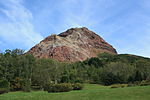 |
|
| Daisetsuzan (大雪山?) |
—
|
—
|
4 | Kamikawa, Higashikawa, Biei and Shintoku, Hokkaidō 43°40′58.87″N 142°53′55.78″E |
 |
|
| Nopporo Forest Park (野幌原始林 nopporo genshirin?) |
—
|
—
|
2.2 | Kitahiroshima, Hokkaidō 43°3′12.46″N 141°30′3.09″E |
 |
|
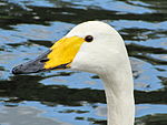
| Swans on Kominato beach and their wintering place (小湊のハクチョウおよびその渡来地 kominato no hakuchō oyobi sono toraichi?) |
—
|
—
|
1.2 | Whooper Swans | Hiranai, Aomori 40°56′14.09″N 140°58′23.88″E |
 |
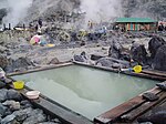
| Getō Onsen Tufa (夏油温泉の石灰華 getō onsen no sekkaika?) |
—
|
—
|
3.8 | Kitakami, Iwate 39°12′36.64″N 140°52′55.74″E |
||
| Nesori petrified wood (根反の大珪化木 nesori no daikeikaboku?) |
—
|
—
|
3.1 | 15–20 Million years old | Ichinohe, Iwate 40°11′24.78″N 141°20′4.42″E |
|
| Yakehashiri lava flow (焼走り熔岩流 yakehashiri yōganryū?) |
—
|
—
|
3.5, 3.10 | Nishine, Iwate 39°52′30.82″N 141°2′51.16″E |
 |
|
| Mount Hayachine and Yakushidake alpine zone, forest vegetation (早池峰山および薬師岳の高山帯・森林植物群落 hayachinesan oyobi yakushidake no kōzantai shinrin shokubutsugunraku?) |
—
|
—
|
2.3 | Hanamaki, Tōno and Kawai, Iwate 39°31′53.71″N 141°28′26.53″E |
||
| onikōbe no megama oyobi ogama kanketsu onsen (鬼首の雌釜および雄釜間歇温泉?) |
—
|
—
|
3.8 | Ōsaki, Miyagi 38°48′0.19″N 140°38′52.81″E |
||
| Tamagawa Hot Spring hokutolite (玉川温泉の北投石 tamagawa onsen no hokutōseki?) |
—
|
—
|
3.1, 3.8 | Hokutolite is a type of radioactive baryte. | Semboku, Akita 39°57′42.57″N 140°43′42.18″E |
 |
| Mount Haguro cedar avenue (羽黒山のスギ並木 hagursan no suginamiki?) |
—
|
—
|
2.1 | Tsuruoka, Yamagata 38°42′13.91″N 139°58′13.33″E |
 |
|
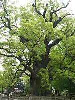
| Large zelkova tree of Higashine (東根の大ケヤキ higashine no ōkeyaki?) |
—
|
—
|
2.1 | More than 1000 year old, and perimeter larger than 12 (m?), largest zelkova tree in Japan | Higashine, Yamagata 38°26′31.16″N 140°24′6.28″E |
|
| Natural habitat Pinguicula ramosa (コウシンソウ自生地 higashine no ōkeyaki?) |
—
|
—
|
2.12 | A species of butterwort endemic to Nikkō National Park | Nikkō, Tochigi 36°40′27.13″N 139°21′42.9″E |
 |
| Mount Asama lava tree mold (浅間山熔岩樹型 asamayama yōganjukei?) |
—
|
—
|
3.2, 3.7, 3.10 | Tsumagoi, Gunma 36°26′53.57″N 138°30′56.25″E |
||
| Wisteria at Ushijima (牛島のフジ ushijima no fuji?) |
—
|
—
|
2.1 | Kasukabe, Saitama 35°59′5.83″N 139°46′24.07″E |
||
| Kagami-iwa rock at Mount Mitake (御獄の鏡岩 mitake no kagamiiwa?) |
—
|
—
|
3.1, 3.5 | Kamikawa, Saitama 36°10′45.91″N 139°4′14.18″E |
||
| Tajimagahara Primula sieboldii primrose habitat (田島ヶ原サクラソウ自生地 tajimagahara sakurasō jiseichi?) |
—
|
—
|
2.4 | Saitama, Saitama 35°50′17.41″N 139°36′56.66″E |
 |
|
| Tai-no-ura sea bream habitat (鯛の浦タイ生息地 tai no ura tai seisokuchi?)[73] |
—
|
—
|
1.3 | Kamogawa, Chiba 35°7′5.98″N 140°11′28.67″E |
 |
|
| Ōshima cherry tree (大島のサクラ株 ōshima no sakurakabu?) |
—
|
—
|
2.1 | Single tree, 7.9 m (26 ft) circumference; species is native to Ōshima and Izu Peninsula | Ōshima, Tokyo 34°45′49.01″N 139°26′3.07″E |
 |
| Firefly squid sea surface group (ホタルイカ群遊海面 hotaruika-gun yūkaimen?) |
—
|
—
|
1.3 | Toyama and Uozu, Toyama 36°46′36.01″N 137°20′40.69″E |
 |
|
| Uozu buried forest (魚津埋没林 uozu maibutsurin?) |
—
|
—
|
3.1, 3.5 | Tree trunks of a cedar forest partially buried about 2000 years ago; largest has a circumference of ca. 12 m (39 ft) | Shakadō, Uozu, Toyama 36°49′31.5″N 137°24′23.53″E |
 |
| Yakushidake cirque group (薬師岳の圏谷群 yakushidake no kenkokugun?) |
—
|
—
|
3.11 | Toyama, Toyama 36°28′5.64″N 137°32′38.48″E |
||
| Sinter cones (岩間の噴泉塔群 iwama no funsentōgun?) |
—
|
—
|
3.8 | Hakusan, Ishikawa 36°13′39.32″N 136°46′11.69″E |
||
| Narusawa lava tree mold (鳴沢熔岩樹型 narusawayōganjukei?) |
—
|
—
|
3.6, 3.10 | Narusawa, Yamanashi 35°25′34.06″N 138°42′3.05″E |
 |
|
| Shirahone Onsen stalagmite and spherical limestones (白骨温泉の噴湯丘と球状石灰石 shirahone onsen no funtōkyū to kyūjōsekkaiseki?) |
—
|
—
|
3.8 | Matsumoto, Nagano 36°8′51.72″N 137°37′28.85″E |
||
| Neodani Fault (根尾谷断層 neodani dansō?) |
—
|
—
|
3.5 | Motosu, Gifu 35°37′1.62″N 136°37′14.98″E |
 |
|
| Itoshiro cedar (石徹白のスギ itoshiro no sugi?) |
—
|
—
|
2.1 | Circumference 14 m (46 ft) | Gujō, Gifu 36°0′5.83″N 136°46′18.49″E |
 |
| Kariyado gebazakura (狩宿の下馬ザクラ kariyado no gebazakura?) |
—
|
—
|
2.1 | Oldest tree of the mountain sakura, crown 21.81 m (71.6 ft) (EW) and 16.33 m (53.6 ft) (NS) | Fujinomiya, Shizuoka 35°18′6.92″N 138°35′19.59″E |
|
| Wakutama pond (湧玉池 wakutama no ike?) |
—
|
—
|
3.10 | Fujinomiya, Shizuoka 35°13′38.07″N 138°36′41.14″E |
 |
|
| Nagaoka fireflies and their habitat (長岡のゲンジボタルおよびその発生地 nagaoka no genjibotaru oyobi sono hassei?) |
—
|
—
|
1.2 | Maibara, Shiga 35°21′22.54″N 136°22′4.84″E |
||
| Kasugayama Primeval Forest (春日山原始林 kasugayama genshirin?) |
—
|
—
|
2.2 | Part of the World Heritage Site "Historic Monuments of Ancient Nara" | Nara, Nara 34°40′56.19″N 135°51′46.13″E |
 |
| Daisen agarwood single species forest (大山のダイセンキャラボク純林 daisen no daisenkyaraboku junrin?) |
—
|
—
|
2.2 | Daisen, Tottori 35°29′0.95″N 133°30′28.51″E |
||
| Daikon Island lava tubes (大根島の熔岩隧道 daikonjima no yōganzuidō?) |
—
|
—
|
3.6, 3.10 | Matsue, Shimane 35°29′42.59″N 133°10′34.42″E |
||
| Akiyoshi plateau (秋吉台 akiyoshidai?) |
—
|
—
|
3.1, 3.3, 3.6, 3.9 | Karst topography | Mine, Yamaguchi 34°14′11.14″N 131°17′26.05″E |
|
| Akiyoshi cave (秋芳洞 akiyoshidō?) |
—
|
—
|
3.6, 3.9 | At 8.7 km (5.4 mi) second longest cave in Japan | Mine, Yamaguchi 34°13′40.17″N 131°18′12.32″E |
 |
| Cranes at Yashiro and their wintering place (八代のツルおよびその渡来地 yashiro no tsuru oyobi sono toraichi?) |
—
|
—
|
1.2 | Hooded Cranes | Shūnan and Kudamatsu, Yamaguchi 34°5′56.19″N 131°56′49.83″E |
|
| Giant camphor tree in Kamo (加茂の大クス kamo no ōkusu?) |
—
|
—
|
2.1 | Higashimiyoshi, Tokushima 34°2′27.39″N 133°55′54.92″E |
||
| Chinese Juniper at Hōshō-in (宝生院のシンパク hōshōin no shinpaku?) |
—
|
—
|
2.1 | 23 m (75 ft) high, 15 m (49 ft) circumference at ground level | Tonoshō, Kagawa 34°29′36.11″N 134°11′49.86″E |
|
| Yakama potholes (八釜の甌穴群 yakama no ōketsugun?) |
—
|
—
|
3.9 | Kumakōgen, Ehime 33°42′13.6″N 132°57′38.39″E |
||
| Common Jay at Kōchi and its habitat (高知市のミカドアゲハおよびその生息地 kōchishi no mikadoageha oyobi sono seisokuchi?) |
—
|
—
|
1.2 | Kōchi, Kōchi 33°33′13.06″N 133°32′24.07″E |
 |
|
| Giant cedars at Sugi (杉の大スギ sugi no ōsugi?) |
—
|
—
|
2.1 | Two stems, each about 16 m (52 ft) circumference | Ōtoyo, Kōchi 33°45′20.17″N 133°39′47.01″E |
|
| Japanese Box primeval forest at Mount Kosho (古処山ツゲ原始林 koshosan tsuge genshirin?) |
—
|
—
|
2.1 | Asakura and Kama, Fukuoka 33°28′54.67″N 130°43′29.8″E |
 |
|
| Camphor tree primeval forest at Mount Tachibana (立花山クスノキ原始林 tachibanayama kusunoki genshirin?) |
—
|
—
|
2.2, 2.10 | Shingū and Hisayama, Fukuoka 33°40′45.67″N 130°28′6.23″E |
 |
|
| Mucuna sempervirens at Aira (相良のアイラトビカズラ aira no airatobikazura?) |
—
|
—
|
2.1, 2.12 | Kikuka, Kumamoto 33°3′51.16″N 130°46′5.53″E |
||
| Aoshima subtropical plant communities (青島亜熱帯性植物群落 aoshima anettai seishokubutsugunraku?) |
—
|
—
|
2.2 | Aoshima, Miyazaki, Miyazaki 31°48′18.69″N 131°28′32.7″E |
 |
|
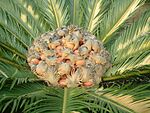
| Sago palm natural habitat at Cape Toi (都井岬ソテツ自生地 toimisaki sotetsu jiseichi?) |
—
|
—
|
2.10 | Kushima, Miyazaki 31°21′54.78″N 131°20′24.03″E |
 |
|
| Mitrastema at Uchiumi (内海のヤッコソウ発生地 uchiumi no yakkosō hasseichi?) |
—
|
—
|
2.12 | Mitrastema yamamotoi | Miyazaki, Miyazaki 31°44′28.97″N 131°28′3.81″E |
|
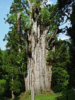
| Yakushima primeval cedar forest (屋久島スギ原始林 yakushima sugi genshirin?) |
—
|
—
|
2.2 | Includes with the Jōmon Sugi, the oldest specimen of Cryptomeria japonica | Yakushima, Kagoshima 30°19′40.23″N 130°31′23.06″E |
 |
| Kamō camphor tree (蒲生のクス kamō no kesu?) |
—
|
—
|
2.1 | Height: 30 m (98 ft), circumference: 24 m (79 ft) | Kamō, Kagoshima 31°45′44.38″N 130°34′11.77″E |
 |
| Origin of Kandelia obovata at Kiire (喜入のリュウキュウコウガイ産地 kiire no ryūkyōkōgai sanchi?) |
—
|
—
|
2.10 | Kagoshima, Kagoshima 31°22′29.34″N 130°32′49.26″E |
 |
|
| Natural habitat of the sago palm in Kagoshima Prefecture (鹿児島県のソテツ自生地 kagoshimaken no sotetsu jiseichi?) |
—
|
—
|
2.10 | Yamagawa, Bonotsu, Sata and Uchinoura, Kagoshima 31°21′13.09″N 130°42′15.64″E |
 |
|
| Cranes in Kagoshima Prefecture and their wintering place (鹿児島県のツルおよびその渡来地 kagoshimaken no tsuru oyobi sono toraichi?) |
—
|
—
|
1.2 | Hooded Cranes | Izumi, Kagoshima 32°6′9.52″N 130°16′25.75″E |
 |
| Birōjima subtropical plant communities (枇榔島亜熱帯性植物群落 birōjima anettai seishokubutsugunraku?) |
—
|
—
|
2.2, 2.10 | Shibushi, Kagoshima 31°25′45.3″N 131°7′1.89″E |
 |
|
| Shirouma mountain range alpine plant zone (白馬連山高山植物帯 shiroumarenzan kōzanshokubutsutai?) |
—
|
—
|
2.3 | Asahi and Kurobe in Toyama; Hakuba in Nagano; Itoigawa in Niigata 36°38′56.9″N 137°44′55.73″E |
 |
|
| Ozegahara (尾瀬 oze?) |
—
|
—
|
4 | Yunotani, Niigata; Katashina, Gunma; Hinoemata, Fukushima 36°56′33.93″N 139°13′59.41″E |
 |
|
| Short-tailed Albatross (アホウドリ ahōdori?) |
—
|
—
|
1.2 | Tokyo and Okinawa |  |
|
| Amami Rabbit (アマミノクロウサギ amami no kuro usagi?) |
—
|
—
|
1.1 | Tokunoshima and Amami Ōshima, Kagoshima |  |
|
| Iriomote Cat (イリオモテヤマネコ iriomote yamaneko?) |
—
|
—
|
1.1 | Endemic to one island (Iriomote) | Iriomote, Okinawa | 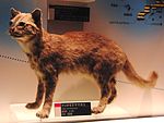 |
| Japanese giant salamander (オオサンショウウオ ōsanshōuo?) |
—
|
—
|
1.2 | At up to 1.5 m (4 ft 11 in) length, the second largest salamander in the world[74] | 11 prefectures, among others: Gifu, Mie, Hyōgo, Hiroshima, Shimane, Tottori, Ōita |  |
| Japanese Serow (カモシカ kamoshika?) |
—
|
—
|
1.1 | found on all main Japanese islands except for Hokkaidō | 29 prefectures including Aomori |  |
| Otter (カワウソ kawauso?) |
—
|
—
|
1.2 | various | 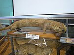 |
|
| Crested Serpent-eagle (カンムリワシ kanmuriwashi?) |
—
|
—
|
1.1 | Okinawa | 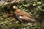 |
|
| Oriental Stork (コウノトリ kō no tori?) |
—
|
—
|
1.2 | Hyōgo and Fukui |  |
|
| Red-crowned Crane (タンチョウ tanchō?) |
—
|
—
|
1.2 | Hokkaidō |  |
|
| Crested Ibis (トキ toki?) |
—
|
—
|
1.2 | Niigata and Ishikawa |  |
|
| Okinawa Woodpecker (ノグチゲラ noguchigera?) |
—
|
—
|
1.1 | Endemic to Okinawa Island | Okinawa Island, Okinawa |  |
| Bonin White-eye (メグロ meguro?) |
—
|
—
|
1.1 | Endemic to the Bonin Islands | Bonin Islands, Tokyo | |
| Rock Ptarmigan (ライチョウ raichō?) |
—
|
—
|
1.2 | Toyama, Nagano, Niigata, Yamanashi, Shizuoka, Gifu | 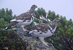 |
|
| Long-Tailed Fowl of Tosa (土佐のオナガドリ tosa no onagadori?) |
—
|
—
|
1.4 | Nankoku, Kōchi |


0 comments:
Post a Comment